
Centralhatchee, Georgia
Centralhatchee, Georgia | |
|---|---|
 Centralhatchee in 2012 | |
 Location in Heard County and the state of Georgia | |
| Coordinates: 33°22′7″N 85°6′15″W / 33.36861°N 85.10417°W | |
| Country | United States |
| State | Georgia |
| County | Heard |
| Government | |
| • Mayor | Barbie Crockett |
| Area | |
| • Total | 3.28 sq mi (8.49 km2) |
| • Land | 3.28 sq mi (8.49 km2) |
| • Water | 0.00 sq mi (0.00 km2) |
| Elevation | 846 ft (258 m) |
| Population (2020) | |
| • Total | 348 |
| • Density | 106.19/sq mi (41.01/km2) |
| Time zone | UTC-5 (Eastern (EST)) |
| • Summer (DST) | UTC-4 (EDT) |
| ZIP Code | 30217 |
| Area code | 706 |
| FIPS code | 13-15026[2] |
| GNIS feature ID | 0355098[3] |
Centralhatchee is a small village in Heard County, Georgia, United States. The population was 348 in 2020.
History
[edit]The town of Centralhatchee was originally a militia district known as "Black Ankle". The community of Glenloch, to the north, was known as "Blue Shin". The geographic configuration of these two communities, according to Native American legend, resembled the ankle and shin portion of the leg and foot. The town became part of Heard County when the county was formed from parts of Carroll, Troup and Coweta counties in 1830.
The town was chartered in 1903 with the name "Centralhatchee". The community takes its name from nearby Centralhatchee Creek.[4]
Geography
[edit]Centralhatchee is located in northern Heard County at 33°22′7″N 85°6′15″W / 33.36861°N 85.10417°W (33.368476, -85.104182).[5] Centralhatchee Creek, a south-flowing tributary of the Chattahoochee River, passes just outside of the town limits to the west.
U.S. Route 27, a four-lane highway, passes through the west side of town, leading south 7 miles (11 km) to Franklin, the Heard County seat, and north 16 miles (26 km) to Carrollton.
According to the United States Census Bureau, the town has a total area of 3.3 square miles (8.5 km2), all land.[6]
Demographics
[edit]| Census | Pop. | Note | %± |
|---|---|---|---|
| 1910 | 119 | — | |
| 1920 | 151 | 26.9% | |
| 1930 | 176 | 16.6% | |
| 1940 | 201 | 14.2% | |
| 1950 | 239 | 18.9% | |
| 1960 | 174 | −27.2% | |
| 1970 | 186 | 6.9% | |
| 1980 | 240 | 29.0% | |
| 1990 | 301 | 25.4% | |
| 2000 | 383 | 27.2% | |
| 2010 | 408 | 6.5% | |
| 2020 | 348 | −14.7% | |
| U.S. Decennial Census[7] | |||
As of the census of 2000, there were 383 people, 136 households, and 105 families residing in the town.[2] In 2020, its population was 348.
Notable person
[edit]- Roy Lee Johnson, R&B and soul songwriter, singer and guitarist
- Hugh McGraw, Sacred Harp songleader and composer
See also
[edit]References
[edit]- ^ "2020 U.S. Gazetteer Files". United States Census Bureau. Retrieved December 18, 2021.
- ^ a b "U.S. Census website". United States Census Bureau. Retrieved January 31, 2008.
- ^ "US Board on Geographic Names". United States Geological Survey. October 25, 2007. Retrieved January 31, 2008.
- ^ Krakow, Kenneth K. (1975). Georgia Place-Names: Their History and Origins (PDF). Macon, GA: Winship Press. p. 38. ISBN 0-915430-00-2.
- ^ "US Gazetteer files: 2010, 2000, and 1990". United States Census Bureau. February 12, 2011. Retrieved April 23, 2011.
- ^ "Geographic Identifiers: 2010 Demographic Profile Data (G001): Centralhatchee town, Georgia". American Factfinder. U.S. Census Bureau. Retrieved May 18, 2017.[dead link]
- ^ "Census of Population and Housing". Census.gov. Retrieved June 4, 2015.
External links
[edit]![]() Media related to Centralhatchee, Georgia at Wikimedia Commons
Media related to Centralhatchee, Georgia at Wikimedia Commons
Municipalities and communities of Heard County, Georgia, United States | ||
|---|---|---|
| Cities | 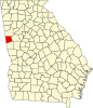 | |
| Town | ||
| CDP | ||
| Other unincorporated communities | ||
| Ghost town | ||
| Footnotes | ‡This populated place also has portions in an adjacent county or counties | |
| Authority control databases: Geographic |
|---|