
Guilford, Connecticut
Guilford, Connecticut | |
|---|---|
| Town of Guilford | |
 Guilford Green | |
 Seal | |
| Motto: "Discover A Piece Of Connecticut History"[1] | |
  | |
   | |
| Coordinates: 41°17′N 72°41′W / 41.283°N 72.683°W | |
| Country | |
| U.S. state | |
| County | New Haven |
| Region | South Central CT |
| Settled | May 19, 1639 |
| Established | October 15, 1644 |
| Named for | Guildford, Surrey |
| Government | |
| • Type | Selectman-town meeting |
| • First selectman | Matthew T. Hoey III (D)[2] |
| • Selectman | Louis Federici (D) |
| • Selectman | Sandra Ruoff (D) |
| • Selectman | Charles Havrda (R) |
| • Selectman | Susan Renner (R) |
| Area | |
| • Total | 49.7 sq mi (128.7 km2) |
| • Land | 47.1 sq mi (121.9 km2) |
| • Water | 2.7 sq mi (6.9 km2) |
| Elevation | 56 ft (17 m) |
| Population (2020) | |
| • Total | 22,073 |
| • Density | 440/sq mi (170/km2) |
| • Demonym | Guilfordian |
| Time zone | UTC−5 (Eastern) |
| • Summer (DST) | UTC−4 (Eastern) |
| ZIP Code | 06437 |
| Area code(s) | 203/475 |
| FIPS code | 09-34950 |
| GNIS feature ID | 0213438 |
| Website | www |
Guilford is a town in New Haven County, Connecticut, United States, that borders Madison, Branford, North Branford and Durham, and is situated on I-95 and the Connecticut coast. The town is part of the South Central Connecticut Planning Region. The population was 22,073 at the 2020 census.[3]
History
[edit]
Prior to European colonization, the area that became Guilford was the site of Menunkatuck, a Quinnipiac village.[4]
By 1614, the Dutch had surveyed, charted, and established New Netherland, a colonial province, with claimed territories from the Delmarva Peninsula to Cape Cod. This included claims over the Quinnipiac territory. However, a lack of any significant Dutch presence in the area gave English settlers an opportunity to settle in the Quinnipiac territory.[5]
In June 1637 during the Pequot War, a force of 100 English soldiers and Narragansett, Mohegan, and Montauk allies arrived from Long Island in pursuit of the Pequot grand sachem Sassacus near Menunkatuck. At a neck of land known today as Sachems Head, they captured and executed three Pequot sachems before continuing on west in pursuit of Sassacus.[6]
In 1639, a group of 24 English Puritan families led by Rev. Henry Whitfield chose to settle near the new English settlement of Quinnipiac (later New Haven), in the vicinity of Menukatuck[7]. The settlers drafted and signed the Plantation Covenant on June 1, 1639 while at sea. On September 29, 1639, the colonists secured a land grant for their settlement from Shaumpishuh, the female sachem of Menunkatuck.[8] Guilford was admitted to New Haven Colony in 1643.[9]
Guilford was named after the town of Guildford, England,[10] the native home of a share of its first English settlers.[11] In early maps of the Connecticut Colony, the town is seen on several maps as "Gilford."
.jpg)
Guilford is considered by some to have the third largest collection of historic homes in New England, with important buildings from the 17th, 18th, and 19th centuries.[12] There are five historic house museums, including Dudley Farm and the Henry Whitfield House (1639), the oldest dwelling house in Connecticut and the oldest stone house built by English settlers in North America. The Comfort Starr House (1695) is one of the oldest wooden framed private dwellings in Connecticut, and one of the few houses remaining of the original signers who settled Guilford.[13]
In June 1781, during the American Revolution, a skirmish was fought on Leete's Island between the Associated Loyalists and local militia under Captain Peter Vail.

Geography
[edit]According to the United States Census Bureau, the town has a total area of 49.7 square miles (129 km2), of which 47.0 square miles (122 km2) is land and 2.7 square miles (6.9 km2 or 5.39%) is water.
The primary settlement in Guilford, known as Guilford Center, is located in the southern part of town around the intersection of U.S. Route 1 and Connecticut Route 77. It is served by three exits of Interstate 95, which passes just north of the town center. The Guilford Center census-designated place had a population of 2,597 at the 2010 census.[14]
The northwest side of Guilford is flanked by the Metacomet Ridge, a mountainous trap rock ridgeline that stretches from Long Island Sound to nearly the Vermont border. Important features of the Metacomet ridge in Guilford include Totoket Mountain; its most notable peak, Bluff Head; and two eastern high points on the Totoket Mountain ridge named East Sugarloaf and West Sugarloaf. The 50-mile (80 km) Mattabesett Trail traverses Bluff Head; a shorter network of trails criss-cross the Sugarloaves. Guilford also contains the Westwoods Trail System which covers 39 miles (63 km) of trails on 1,200 acres (4.9 km2) of land.
Transportation
[edit]
The Shore Line East train stops at Guilford station with service to Branford, East Haven, New Haven and New London, and the Connecticut Transit S bus travels between Guilford and New Haven several times each day.
Principal communities
[edit]- Guilford Center (Guilford's Green)
- Leetes Island
- North Guilford
- Nut Plains
- Shell beach
- Sachems Head
Other minor communities and geographic features in Guilford are Guilford Lakes, Indian Cove, and Old Quarry.
Demographics
[edit]| Census | Pop. | Note | %± |
|---|---|---|---|
| 1820 | 4,131 | — | |
| 1850 | 2,653 | — | |
| 1860 | 2,624 | −1.1% | |
| 1870 | 2,576 | −1.8% | |
| 1880 | 2,782 | 8.0% | |
| 1890 | 2,780 | −0.1% | |
| 1900 | 2,785 | 0.2% | |
| 1910 | 3,001 | 7.8% | |
| 1920 | 2,803 | −6.6% | |
| 1930 | 3,117 | 11.2% | |
| 1940 | 3,544 | 13.7% | |
| 1950 | 5,092 | 43.7% | |
| 1960 | 7,913 | 55.4% | |
| 1970 | 12,033 | 52.1% | |
| 1980 | 17,375 | 44.4% | |
| 1990 | 19,848 | 14.2% | |
| 2000 | 21,398 | 7.8% | |
| 2010 | 22,375 | 4.6% | |
| 2020 | 22,073 | −1.3% | |
| U.S. Decennial Census[15] | |||
As of the census[16] of 2000, there were 21,398 people, 8,151 households, and 6,039 families residing in the town. The population density was 454.8 inhabitants per square mile (175.6/km2). There were 8,724 housing units at an average density of 185.4 per square mile (71.6/km2). The racial makeup of the town was 96.04% White, 0.93% African American, 0.05% Native American, 1.65% Asian, 0.41% from other races, and 0.93% from two or more races. Hispanic or Latino of any race were 2.13% of the population.
There were 8,151 households, out of which 35.6% had children under the age of 18 living with them, 64.4% were married couples living together, 7.2% had a female householder with no husband present, and 25.9% were non-families. Of all households 21.6% were made up of individuals, and 8.6% had someone living alone who was 65 years of age or older. The average household size was 2.59 and the average family size was 3.04.
In the town, the population was spread out, with 25.4% under the age of 18, 4.4% from 18 to 24, 26.2% from 25 to 44, 31.2% from 45 to 64, and 12.8% who were 65 years of age or older. The median age was 42 years. For every 100 females, there were 92.8 males. For every 100 females age 18 and over, there were 89.5 males.
The median income for a household in the town was $76,843, and the median income for a family was $87,045 (these figures had risen to $90,026 and $104,852 respectively as of a 2007 estimate[17]). Males had a median income of $60,623 versus $40,307 for females. The per capita income for the town was $37,161. About 2.3% of families and 3.1% of the population were below the poverty line, including 3.4% of those under age 18 and 3.8% of those age 65 or over.
| Voter registration and party enrollment as of October 30, 2014[18] | |||||
|---|---|---|---|---|---|
| Party | Active voters | Inactive voters | Total voters | Percentage | |
| Democratic | 4,743 | 551 | 5,294 | 33.05% | |
| Republican | 3,183 | 333 | 3,516 | 21.95% | |
| Unaffiliated | 5,995 | 1113 | 7,108 | 44.38% | |
| Minor parties | 94 | 5 | 99 | 0.62% | |
| Total | 14,015 | 2,002 | 16,017 | 100% | |
In the 2008 presidential election, Democrat Barack Obama received 61.02% of the town vote, against 38.06% for Republican John McCain.[19] In 2016, Democrat Hillary Clinton carried the town with 59.2% over Republican Donald Trump with 37.1%.[20]
Economy
[edit]American Cruise Lines has its headquarters in Guilford.[21][22] There are many small businesses throughout the town, including the shops on the Guilford Green.
List of town parks
[edit]The town government operates these parks:[23]
- Bittner Park: 123 acres (0.50 km2) of woodlands and 15 acres (61,000 m2) of playground, a lighted softball field (Cash Mitchell Field), baseball and soccer fields, jogging/walking path; trout trail; roller sports complex with a skate park, roller hockey and roller blading. Ice skating available in winter.[23]
- Chaffinch Island: Picnic areas, short walking trails, salt marsh.[23]
- Chittenden Park: Softball and soccer fields, bocce courts, picnicking, unsupervised beach area[23]
- Jacobs Beach: Public swimming (salt water), playground, volleyball courts, picnicking; nonresidents may use the beach, but are charged a daily fee at the gate.[23]
- Lake Quonnipaug: Public swimming, picnic area, small craft launch.[23]
- Long Hill: 8-acre (32,000 m2) park with playing fields for baseball, football, soccer/lacrosse and field hockey[23]
- Mill Pond: Lighted, supervised ice skating in winter; fishing[23]
- Nut Plains: Lacrosse/soccer field[23]
- Town Green: available for special events[23]
Notable locations
[edit]Guilford, Connecticut is noted for its rolling farmland, its avoidance of the density and sprawl that has occurred from land use regulations of its neighboring communities, and its numerous historic homes and sites.[24]
- Bishop's Orchards
- Guilford Green [25]
- Rothberg Institute For Childhood Diseases
- Westwoods Trails: conservation area managed by the Guilford Land Conservation Trust [26]
Historic Structures and Districts
[edit]The town is home to one of the most well-preserved and intact central villages in the region. Its historical significance is further underscored by the presence of over 450 historical houses dating from the 17th to the 19th centuries.[27]
Among its notable designations, Guilford includes a National Historic Landmark, four designated areas, and 11 individual structures listed on the National Register of Historic Places. Additionally, the town features two local historic districts encompassing a total of 226 buildings within the downtown area, highlighting its rich historical and architectural legacy.
| Building | Image | First built | National Register of Historic Places listed | Current use | Notes |
|---|---|---|---|---|---|
| Henry Whitfield House | 
|
1639 | Yes | House museum | Oldest house in Connecticut and the oldest stone house in New England. |
| Acadian House | 
|
1670 | Yes | Residential | One of Connecticut's oldest surviving houses. Notable for its later occupation by refugee Acadians following their 1755 deportation from Nova Scotia. |
| Elisha Pitkin House | 
|
1690 | Yes | Residential | Moved to Guilford from East Hartford in 1955 |
| Comfort Starr House | 
|
1695 | No | Residential | Classic New England saltbox home. |
| Pelatiah Leete House | 
|
1710 | Yes | Residential | Oldest surviving house associated with the locally prominent Leete family, who were among the founders of New Haven Colony. |
| Hyland House | 
|
1713 | Yes | House museum | Open to the public as a museum since 1918. |
| Jared Eliot House | 
|
1723 | Yes | Residential | Well-preserved example of period residential architecture |
| Thomas Burgis II House | 
|
1735 | Yes | Residential | One of Guilford's finest and best-documented colonial-era houses |
| Sabbathday House | 
|
1735 | Yes | Residential | One of two Sabbathday houses to survive in the town. Built for the purpose of sheltering church-going families between morning and afternoon services. |
| Griswold House | 
|
1764 | Yes | House museum | Museum includes the saltbox house, a historic blacksmith shop, a barn with farm tools and implements, two corn cribs and a Victorian era three seat outhouse. |
| Falkner Island Light | .jpg)
|
1802 | Yes | Lighthouse | Second-oldest extant lighthouse in Connecticut. Commissioned by Thomas Jefferson. |
| Medad Stone Tavern | 
|
1803 | Yes | House museum | Example of early 19th-century Federal period architecture. Never used as a tavern. |
| First Congregational Church | 
|
1830 | No | Church | Third church building for a congregation founded in 1643. |
Historic districts include:
- Guilford Historic Town Center
- Dudleytown Historic District
- Meeting House Hill Historic District (North Guilford)
- Route 146 Historic District (Branford and Guilford)
Other Notable Structures
[edit]| Building | Image | Built | Current use | Notes |
|---|---|---|---|---|
| Spaceship | 
|
1987 | Condos | Uniqiue condo building designed by architect Wilfred J. O. Armster. |
Notable people
[edit]- Wilfred J. O. Armster. (1938–2019), architect
- Humbert Allen Astredo (1929–2016), American stage, film, and television actor best known for the numerous roles he performed on the daytime Gothic horror soap opera Dark Shadows, most notably that of the warlock Nicholas Blair
- Abraham Baldwin (1754–1807), minister, patriot, politician, and founding father[28]
- Robert Elliott De Forest (1845–1924), Democratic member of the United States House of Representatives, mayor of Bridgeport, Connecticut, member of the Connecticut Senate and Connecticut House of Representatives, born in Guilford
- Ronald Duman (1954–2020), neuroscientist died in Guilford
- Moses Gunn (1929–1993), American actor, resided in Guilford since the 1970s
- Fitz-Greene Halleck (1790–1867), American poet and author
- Samuel Johnson (1696-1772), American colonial intellectual and educator; first president of King's College (now Columbia University)
- Samuel Johnson Jun'r (1757–1836), schoolmaster and teacher of Fitz-Greene Halleck; as the compiler of A School Dictionary (1798), the first American lexicographer
- Edward Ruggles Landon (1813–1883), Connecticut politician
- William Leete (c. 1612–1683), Guilford town clerk, justice of the peace, Governor of the New Haven Colony (1661-1665), and Governor of the Colony of Connecticut (1676-1683)
- Leonard C. Lewin (1916–1999), author of The Report from Iron Mountain
- Frank Modell (1917–2016), cartoonist, died in Guilford[29]
- Aldo Parisot (1918–2018), Brazilian-born American cellist and cello teacher
- Lavinia Stoddard (1787–1820), poet, school founder
- Shaumpishuh (d. 1686), sachem of Menunkatuck
- Henry Whitfield (c.1590-c.1657), Guilford founder and Puritan minister
Living
[edit]- Jeffrey Ambroziak, cartographer, inventor, and attorney
- Jamie Arentzen (b. 1970), American guitarist, musician; member of various rock bands including Sky Heroes, American Hi-Fi, Dream Club
- Thom Brooks, political and legal philosopher
- Benjamin Chan, American scientist at Yale University
- Mickey Curry, Drummer for Bryan Adams
- David DeMille, physicist and Professor of Physics at University of Chicago.
- Joe Flood, musician and songwriter
- Nick Fradiani (b. 1985), American Idol season 14 winner, born in Guilford
- Timothy Mellon, heir
- Becki Newton, actress in Ugly Betty and How I Met Your Mother, grew up in Guilford and is a Guilford High School Alumna[30]
- David Allen Sibley, ornithologist, author, and illustrator
- Jennifer Westfeldt, actress and screenwriter known for Kissing Jessica Stein, born in Guilford[31]
- Carl Zimmer, science writer
See also
[edit]References
[edit]- ^ "The Town of Guilford Connecticut". The Town of Guilford Connecticut. Archived from the original on September 23, 2012. Retrieved September 22, 2012.
- ^ "Board of Selectmen". Town of Guilford, Connecticut. Retrieved November 28, 2021.
- ^ "Census - Geography Profile: Guilford town, New Haven County, Connecticut". Retrieved December 16, 2021.
- ^ Smith, Ralph (1877). The History of Guilford Connecticut. Albany, N.Y.: J. Munsell. pp. 46–47.
- ^ https://www.newnetherlandinstitute.org/history-and-heritage/digital-exhibitions/a-tour-of-new-netherland/connecticut
- ^ https://pequotwar.org/about/
- ^ Smith, Ralph (1877). The History of Guilford Connecticut. Albany, N.Y.: J. Munsell. pp. 46–47.
- ^ https://www.masshist.org/object-of-the-month/objects/january-2023
- ^ https://connecticuthistory.org/towns-page/guilford/
- ^ Gannett, Henry (1905). The Origin of Certain Place Names in the United States. Govt. Print. Off. pp. 146.
- ^ The Connecticut Magazine: An Illustrated Monthly. Connecticut Magazine Company. 1903. p. 332.
- ^ The Connecticut Nutmegger, Connecticut Society of Genealogists (Connecticut Society of Genealogists, 1981).
- ^ Federal Writers' Project (1938). Connecticut. Houghton Mifflin Company. ISBN 978-1-60354-007-0.
- ^ "Profile of General Population and Housing Characteristics: 2010 Demographic Profile Data (DP-1): Guilford Center CDP, Connecticut". United States Census Bureau. Retrieved October 15, 2012.
- ^ "Census of Population and Housing". Census.gov. Retrieved June 4, 2015.
- ^ "U.S. Census website". United States Census Bureau. Retrieved January 31, 2008.
- ^ "American FactFinder - Community Facts". factfinder.census.gov. Archived from the original on February 11, 2020. Retrieved February 2, 2022.
- ^ "Registration and Party Enrollment Statistics as of October 30, 2014" (PDF). Connecticut Secretary of State. Archived from the original (PDF) on September 23, 2006. Retrieved June 2, 2015.
- ^ "Connecticut Election 2008 - Presidential Results Margin of Victory" (PDF). magic.lib.uconn.edu. Retrieved May 25, 2020.
- ^ "Connecticut Election Results 2016". The New York Times. August 2017.
- ^ "General Information" Archived January 21, 2012, at the Wayback Machine. American Cruise Lines. Retrieved on January 15, 2012. "American Cruise Lines, Inc. operates from headquarters in Guilford, Connecticut[...]"
- ^ "Cruise News". (Archive) American Cruise Lines. Retrieved on January 15, 2012. "741 Boston Post Road ٠ Suite 200 ٠ Guilford, CT"
- ^ a b c d e f g h i j http://www.courant.com/news/local/hc-ot-guilford,0,3814997.story Web page titled "Guilford" at Hartford Courant Web site, dated August 16, 2006, accessed January 14, 2007
- ^ Hughes, C. J., Guilford, Conn.: Proud of Its Place in New England, the New York Times, September 29, 2019
- ^ Guilford Green
- ^ Guilford Land Conservation Trust
- ^ https://guilfordpreservation.org/illustrated-survey/
- ^ "Abraham Baldwin (1754–1807)" Archived March 18, 2012, at the Wayback Machine, New Georgia Encyclopedia (January 6, 2009), Retrieved on July 21, 2013
- ^ Roberts, Sam (May 29, 2016). "Frank Modell, Longtime New Yorker Cartoonist, Dies at 98". The New York Times.
- ^ "Becki Newton". IMDb. Retrieved August 15, 2021.
- ^ "Jennifer Westfeldt biography at IMDB". IMDB.com. Retrieved May 26, 2015.
External links
[edit]- Town of Guilford official website
- Guilford Keeping Society
- Guilford Preservation Alliance
- Guilford Free Library
- Guilford Public Schools Archived July 7, 2005, at the Wayback Machine
- Guilford Chamber of Commerce Archived April 10, 2007, at the Wayback Machine
- Guilford, Connecticut at City-Data.com
Municipalities and communities of New Haven County, Connecticut, United States | ||
|---|---|---|
| Cities |  | |
| Towns | ||
| Boroughs | ||
| CDPs | ||
| Other communities | ||
Municipalities and communities of South Central Connecticut Planning Region, Connecticut, United States | ||
|---|---|---|
| Cities | 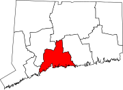 | |
| Towns | ||

| International | |
|---|---|
| National | |
| Geographic | |